
🌀 Hurricane Polo Update: Cat 5 Turn Toward Baja — What It Means for SoCal Surf
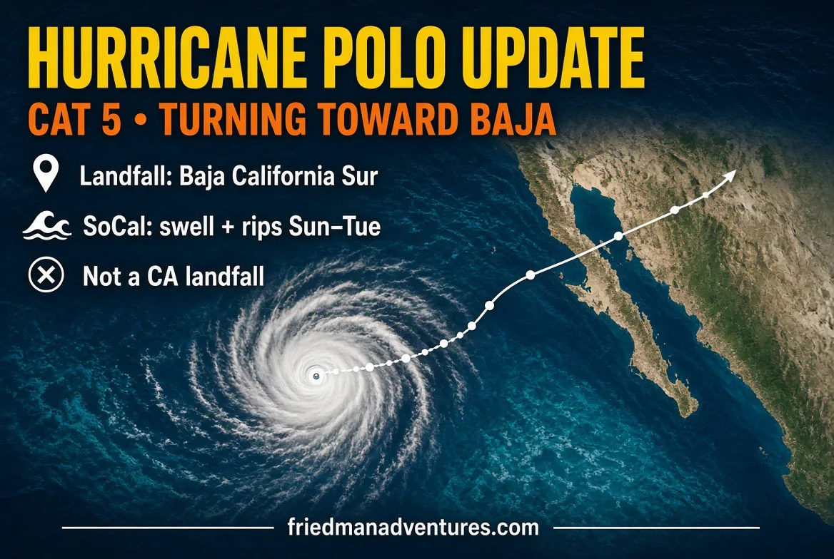
Hurricane Polo is a real monster tonight — Category 5, 180 mph, pressure down around 913 mb — sitting about 395 miles south of Cabo San Lucas and still sliding west at 10 mph. NOAA flew a hurricane hunter through it this afternoon and confirmed those numbers. That’s the official word from the National Hurricane Center as of Advisory 21.
Here’s the trajectory in plain English. Polo keeps heading west through tonight. Saturday it starts that long left-hand turn to the northwest. Sunday it bends more north. Monday it hooks northeast and makes its run at Baja California Sur. NHC has high confidence it comes ashore on the peninsula, then crosses the Sea of Cortez and heads into mainland Mexico. It is not coming to Southern California as a hurricane. Zero model runs put the center on our coast.
Where and when it hits Baja: the center is forecast to approach the Pacific side of Baja California Sur Monday, still a hurricane — weaker than tonight, but still a serious storm. Latest points put it well north of the Los Cabos resort strip, more mid-to-northern BCS (think the Magdalena Bay / Comondú corridor toward the Santa Rosalía side), then through the Gulf. Exact beach is still moving around in the models, which is why watches could go up for parts of BCS as early as tonight or Saturday morning. Rain on the peninsula starts late Sunday into Monday — 4 to 8 inches, isolated 10. That’s flood and mudslide water in steep country. Friends in Cabo, Todos Santos, La Paz, Loreto, and up the Pacific side: have a plan and watch the next advisories.
Southern California: we do not get the wind. We get the leftover. Swells from Polo — and Odalys still hanging in the same ocean — start showing late Sunday and peak Monday–Tuesday on south-facing beaches. Think 4 to 7 feet in a lot of spots, bigger sets at the Wedge and some Orange County / South Bay exposures, stacked on those ~7-foot morning high tides. That’s rip current, beach erosion, and shallow flooding weather for Long Beach, Avalon, Malibu, and the usual low spots. Small chance of a few light showers Sunday night into Monday. Not a soaker. Don’t turn your back on the water. After Marie already chewed the sand this month, give the berms a break.
Fishing angle, because that’s why you’re here. Long-range and Baja panga trips from Cabo through Magdalena and up toward Bahía de los Ángeles are going to get shuffled or cancelled as this thing climbs the peninsula. Ensenada and San Quintín will feel the swell before the rain. Local SoCal surf fishing Sunday through Tuesday is going to be sloppy and dangerous — high water, strong current, junk in the wash. If you’re still going, pick your window around the tide, wear the PFD, and don’t wade like it’s a July sand-crab day. Offshore from San Diego to the Channel Islands, expect a lumpy south swell more than a fish-killer blow.
One more thing in the Eastern Pacific: NHC is watching another disturbance in Polo’s wake that could become a tropical depression late this weekend or early next week. Two storms in the same basin is why the swell forecast has been a little twitchy. We update as they do.
Stay safe, check the official cone at http://hurricanes.gov, and don’t take beach advice from a Facebook comment. Check http://friedmanadventures.com for Captain’s audios, landing and boat counts, bait availability, Friedman Adventures AI, kids corner, and lots more.
Next Friedman Adventures Surf Fishing Festival is Saturday, October 24 at Anderson St / PCH, Sunset Beach. Free, family-friendly, raffles, kids gear. Mark it.
#FriedmanAdventures #HurricanePolo #BajaCalifornia #SurfsideCA #SouthernCalifornia #SurfFishing #EasternPacific #NHC #CaboSanLucas #MagdalenaBay #SeaOfCortez #HighSurf #RipCurrent #LeaveNoOneIndoors #FishingReport #SunsetBeach