
Category 5 Polo Is Parked Off Mexico. Here’s the Timeline — and Why Long Beach Should Watch the Next South Swell.
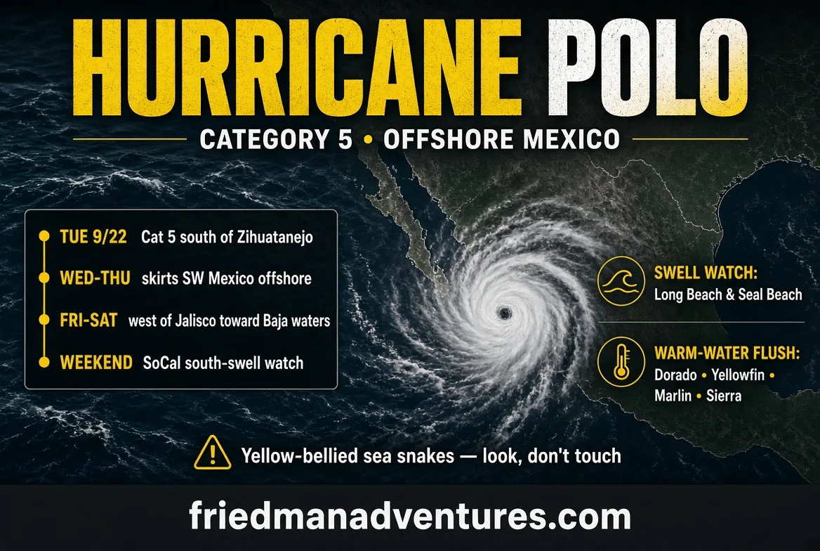
Friends, Venture Family — Polo just went full monster.
As of Tuesday evening, September 22, Hurricane Polo is an extremely dangerous Category 5 storm sitting about 215 miles south of Zihuatanejo and about 360 miles south-southeast of Manzanillo. A NOAA Hurricane Hunter flight found winds near 175 to 180 mph and a pressure down around 892 to 900 millibars. Right now it is almost parked, drifting east at about 1 mph. That is the kind of storm that makes you pay attention even when the center is supposed to stay offshore.
The National Hurricane Center’s forecast is this: Polo turns northwest tonight, then west-northwest over the next couple of days, sliding near the southwestern Mexico coast through midweek while remaining offshore. Tropical storm conditions are expected along the warning area from Tecpan de Galeana to Punta San Telmo by Wednesday, with a watch farther west to Playa Perula. Guerrero and Michoacán are looking at 3 to 6 inches of rain, isolated 8 inches, and that is mudslide and flood country. Swells off that coast are already going to be life-threatening. If you have family or friends from Acapulco through Manzanillo and on toward Puerto Vallarta, check on them. The core is forecast to stay at sea — that can change. Watch the next advisories.
Simple timeline (NHC track, Advisory 9 / 9A):
• Tonight–Wednesday, Sept. 22–23: Still Category 5. Slow northwest then west-northwest. Closest approach window for southwestern Mexico begins.
• Thursday, Sept. 24: Still a major hurricane, working west-northwest off Colima/Jalisco waters. Rain and surf still a problem on the Mexican coast.
• Friday, Sept. 25: Starts to pull farther off. Forecast point west of Jalisco, still a major. Baja Sur offshore waters start to deteriorate.
• Saturday–Sunday, Sept. 26–27: Polo forecast near 19N–22N, well southwest of the Baja tip, still a powerful hurricane. Steering gets messy because Tropical Storm Odalys is out to the west and may become a hurricane. Those two systems can mix swell and make the seas west of Baja confused and ugly.
Polo is not forecast to hit Southern California as a hurricane. What we do have to watch is the leftover energy: long-period south swell, rips, and maybe a pulse of tropical moisture later. Forecasters are split on how much swell actually reaches us — Polo is compact, which can limit how much energy escapes north — but NWS and local reports already have a south-swell / rip-current watch for late weekend into early next week. Odalys may end up being the better swell-maker of the two. Treat it as a watch, not a guarantee.
And we already know what a big south swell can do here.
Just two weeks ago, Hurricane Marie’s swell tore into the Long Beach Peninsula. About 20 homes along Seaside Walk between 63rd and 67th Place were evacuated. The seawall was breached, the boardwalk was chewed up, sand vanished, and at low tide there was roughly a 15-foot drop from the boardwalk down to rock. One home was yellow-tagged. In Seal Beach the emergency sand berms failed, water came over the boardwalk, and parking lots near the pier flooded. Neighbors described the hits like cannonballs. That coast has not had time to heal. If Polo or Odalys sends another long-period south swell into a high tide, those same stretches — Long Beach Peninsula, Seal Beach, Surfside, Sunset — are the first places I am watching. Stay off compromised seawalls. Do not turn a photo op into a rescue.
Now the part anglers always ask about.
A lot of us believe these eastern Pacific hurricanes act like a plunger. They mix and shove warm water north, and behind that water come the visitors. 2026’s El Niño — stacked on a marine heatwave that was already cooking the coast — has given us the best local fishing in decades: yellowtail limits, dorado, yellowfin, bluefin, wahoo, striped marlin, even a 648-pound blue marlin off San Diego this month. That is Cabo fishing in our backyard. It is not over. NOAA still has this El Niño strengthening into winter.
When a storm like Polo stirs the pot, history says keep your eyes open for:
• Dorado and yellowfin sliding farther north
• Sierra mackerel and needlefish in the surf and along the kelp
• Sea turtles working the beach and nearshore
• Hammerheads (protected — look, do not target)
• Blue marlin and striped marlin on the local banks
• And yes, yellow-bellied sea snakes. They are venomous. If one washes up at Seal Beach, Sunset, or Ensenada, do not pick it up. Be very careful.